|
DISCLAIMER
All products content and links on this website are provided for personal interest, educational study.
No guarantees are provided and no responsibility or liability borne concerning the accuracy or timeliness of the published images from any web link.
All charts and web links are provided on an "as is" basis, whose content, accuracy, or suitability is beyond this webmaster control.
For any safety and / or navigational purposes, always consult directly with the appropriate official meteorological department.
THESE PRODUCTS ARE NOT A SUBSTITUTE FOR OFFICIAL FORECASTS AND SHOULD ONLY BE USED FOR SITUATIONAL AWARENESS.
This disclaimer applies to any authorised or unauthorised use of products from this website or from the links.
|
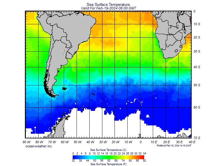
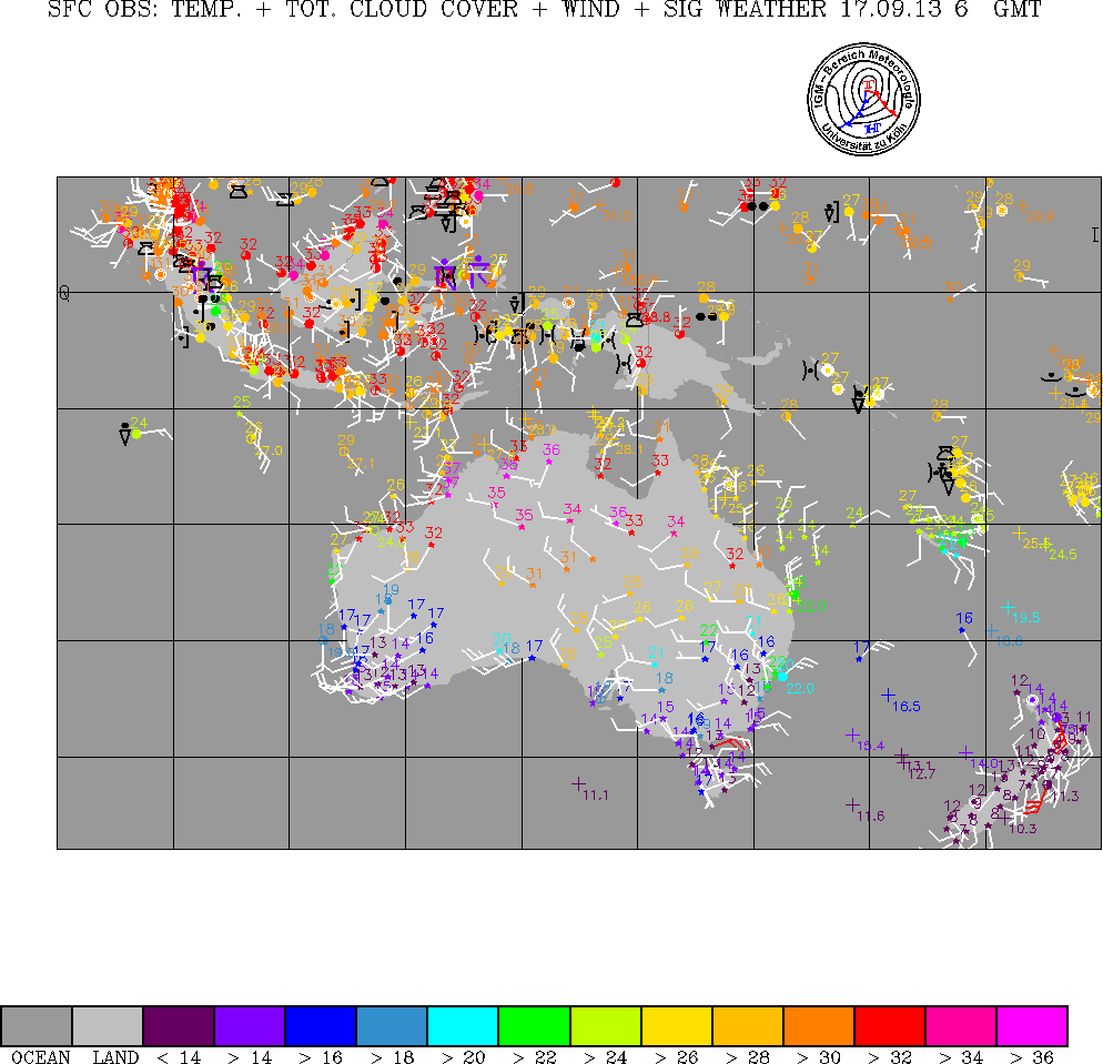
 Home web page university of Wyoming
. . More observations
Home web page university of Wyoming
. . More observations