|
www.weathercharts.org/hurricanes-katrina-rita-wilma |
|
Removed expired links .... updated - 04 December 2020 |
Hurricanes KATRINA and RITA |
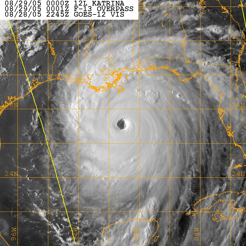
Hurricane Katrina 29 August 2005 2245GMT
Visible - GOES 12.
Central pressure 904 mb -- wind 140 knots
Click on image for larger view (569 KB)
Hurricane Katrina August 2005 and other tropical storms - Satellite images / movie loops |
| Hurricane KATRINA Aftermath - Hires satellite images - RADAR |
| Hurricane Katrina - August 2005 - impact & aftermath - news pictures |
| Hurricanes (most noteworthy since 1900) |
| Katrina - New Orleans - Louisiana - photo gallery |
| Katrina satellite images and hires photos - flooding of New Orleans |
| Katrina chart of Sea surface height and hurricane track across Gulf of Mexico |
Hurricane RITA - September 2005 |
| RITA satellite imagery |
|
Hurricane RITA hires visible satellite images - 250 meter resolution |
| 20 September 2005 18:35 UTC - 250 meter resolution - 6.6MB |
| 21 September 2005 16:10 UTC - 250 meter resolution - 8.4MB |
| 22 September 2005 16:55 UTC - 250 meter resolution - 7.5MB |
| 23 September 2005 19:10 UTC - 250 meter resolution - 6.2MB |
Hurricane WILMA |
| Hurricane WILMA satellite animated imagery . . Youtube |